
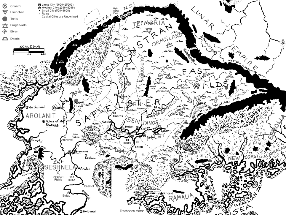
Western Genertela (1,350kb)
drawn by Kevin McDonald
from A Motley Collection of Online Glorantha Maps
『ジェナーテラ・ブック』では分けられてしまっているフロネラ、セシュネラ、ラリオス、カルマニアの西方諸地方が一つの地図に綺麗に収められている。彩色も美しい。
ただし、とくに目新しい情報はない。
Ralios (249kb)
composited by David Dunham
from Maps of Ralios
in East Ralios
|
『ジェナーテラ・ブック』に載っているラリオス、セシュネラ、マニリアの地図をつなぎ合わせたものに、スールコリオンやラリアなどいくつかの地名を加筆してある。 This map is composed three maps are printed in "the Genertela Book" and added some place names; Surkorion, Lalia and so on. |

Ralios (19kb)
drawn by Matti Järvinen
from Maps of Glorantha
in Matti Järvinen’s homepage

Seshunela (16kb)
drawn by Matti Järvinen
from Maps of Glorantha
in Matti Järvinen’s homepage

Seshnela during Second Age (16kb)
drawn by Matti Järvinen
from Maps of Glorantha
in Matti Järvinen’s homepage
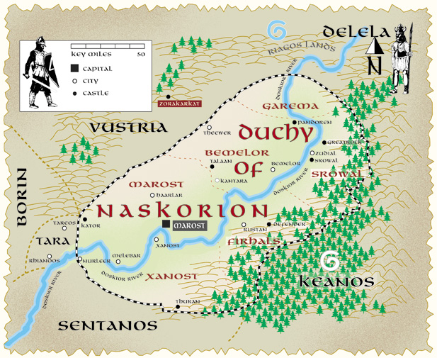
Naskorion (215b)
drawn by Dario Corallo
from Naskorion map
in Tradetalk
|
ナスコリオン公国の諸地域、諸都市の名前が分かる。地図も美しい。 This map shows the regions and the cities in the Duchy of Naskorion. And this map is beautiful. |

Naskorion (11kb)
drawn by Matti Järvinen
from Maps of Glorantha
in Matti Järvinen’s homepage
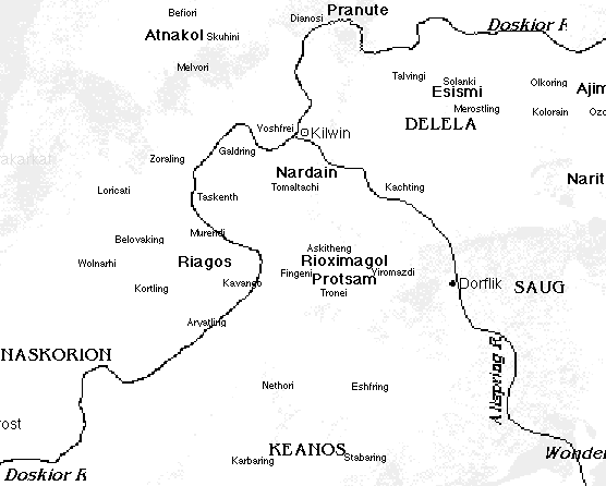
Western Delela (16kb)
drawn by David Dunham
in East Ralios
|
Kilwin を中心とした Delela 西部の諸地域、諸部族の名前が分かる。 This map shows the regions and the tribes in the West Delela around Kilwin. |

Tiskos (107kb)
drawn by Dario Corallo
from The County of Tiskos, in Safelster
in Paolo Guccione Home Page
|
ティスコス伯国内の街道、諸城のほか、各城主の紋章まで分かる。地図も美しい。 This map shows the roads and the casltes in the County of Tiskos. You can know even the emblems of each castle load. And this map is beautiful. |

Tiskos (12kb)
drawn by Matti Järvinen
from Maps of Glorantha
in Matti Järvinen’s homepage

Daranland (10kb)
drawn by Matti Järvinen
from Maps of Glorantha
in Matti Järvinen’s homepage
|
ダランランド伯国内の街道、諸城が分かる。 This map shows the roads and the casltes in the County of Daranland. |

Kustria (15kb)
drawn by Matti Järvinen
from Maps of Glorantha
in Matti Järvinen’s homepage
|
クストゥリア騎士王国内の諸城が分かる。 This map shows the casltes in the Tornament Kingdom of Kustria. |