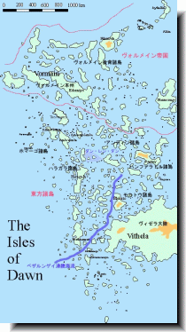
the Isles of Dawn (125kb)
drawn by Malion
from Rough Guide to East Isles
in TOME: The Book of Secrets of Glorantha
|
東方諸島の地図にしては比較的島影がはっきりしており、地名も主要なものは読める。何よりベサルンゲイ沸騰海流などの最新の知見が盛り込まれており、ヴォルメインの国境も描かれている。 |
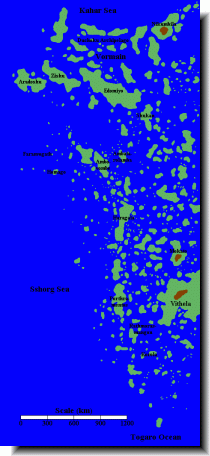
the East Isles (15kb)
drawn by Matti Järvinen
from Maps of Glorantha
in Matti Järvinen’s homepage
|
しばしば耳にする東方諸島の地名が、どこの島なのかがある程度分かる。 Through this map, you can know where some faomus place names of the Eastern Islands are. |
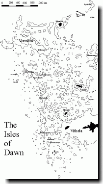
the East Isles (12kb)
from Maps
in Fabulous Worlds
|
文字がつぶれて読めないものもあるが、島影は正確。 Some place names are difficult to read for bad printing. But the shapes of islands are correct. |
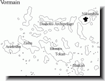
Vormain (8kb)
|
ヴォルメインの地図。各島の名前が載っており、島影も正確。 This map shows Vormain. The main islands' names are. And the shapes of islands are correct. |
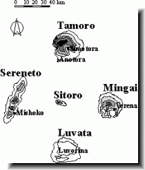
the Korolan Islands (3kb)
from East Isles - The Korolan Islands
in Glorantha - a mighty fine imaginary world
|
ヴィセラの南西にあるコロラ諸島の地図。上記リンク先に各島の説明がある。 This map shows the Korolan Islands where is the south-west of Vithela. On the above linked page, each islands are explained. |