
Fronela & Environs (1,943kb)
drawn by Kevin McDonald
from A Motley Collection of Online Glorantha Maps
フロネラと周囲の関連深い地域が一つの地図に綺麗に収められている。彩色も美しい。
ただし、とくに目新しい情報はない。

Fronela (20kb)
drawn by Matti Järvinen
from Maps of Glorantha
in Matti Järvinen’s homepage

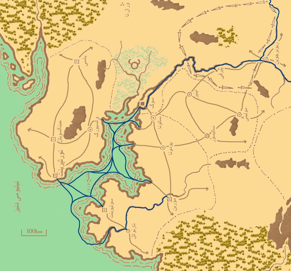
Neleomi Sea (6kb)
drawn by Matti Järvinen
from Maps of Glorantha
in Matti Järvinen’s homepage
|
鯨の巣諸島や赤ヴァデルス諸島なども載っている。 Through this map, you can know where Whalehome Isle & Red Vadeli's Islands are. |
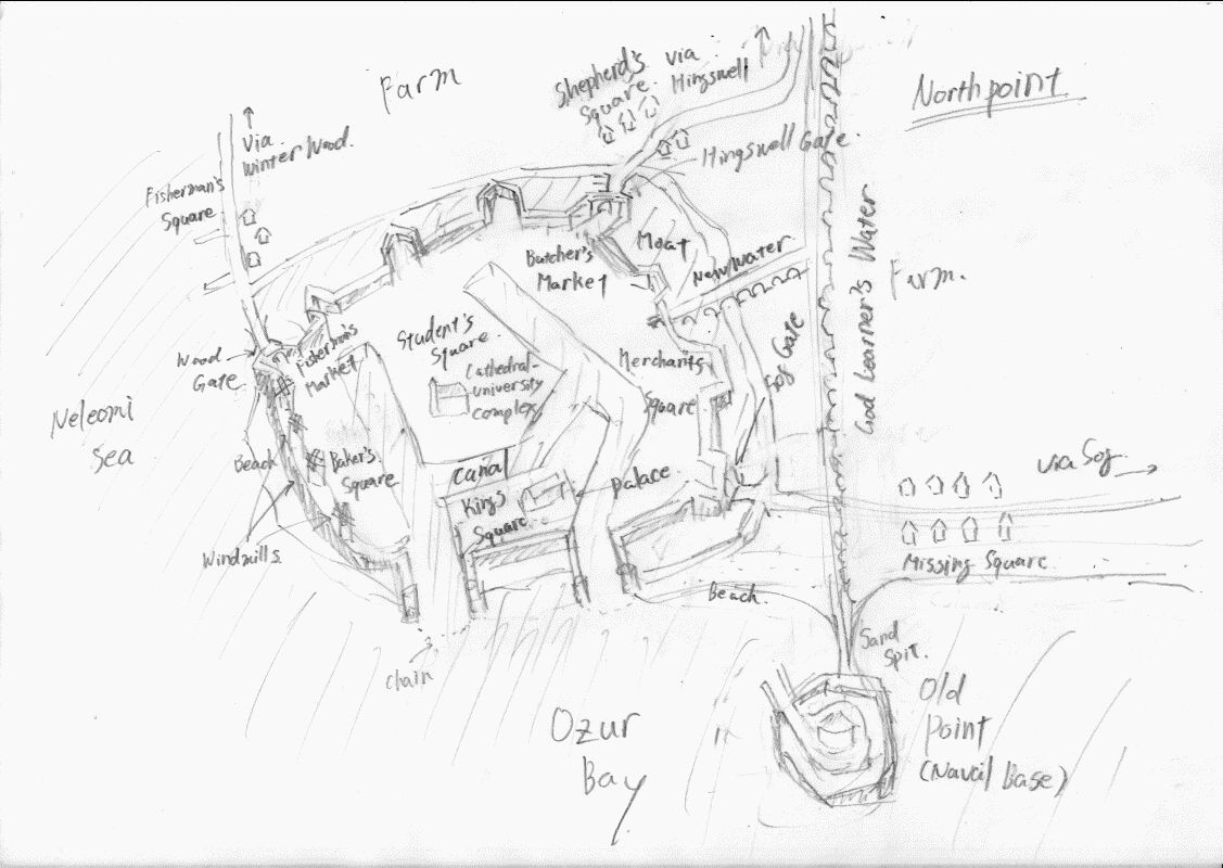
Northpoint (102kb)
drawn by Efendi
from Northpoint
in Liber ob Sciscitatora
|
Efendi の私的な設定によるロスカルム王国の王都ノースポイント。上述リンク先に説明がある。 This map shows Northpoint of the version that Efendi designed. The explanations of this settings are on the page of above linking. |
The Roads on Loskalm (129kb)
drawn by Efendi
Liber ob Sciscitatora
|
Efendi の私的な設定によるロスカルム王国の街道図。説明は記述中。 This map shows the road network of the Loskalm Kingdom of the version that Efendi designed. The explanations of this settings are under writing. |
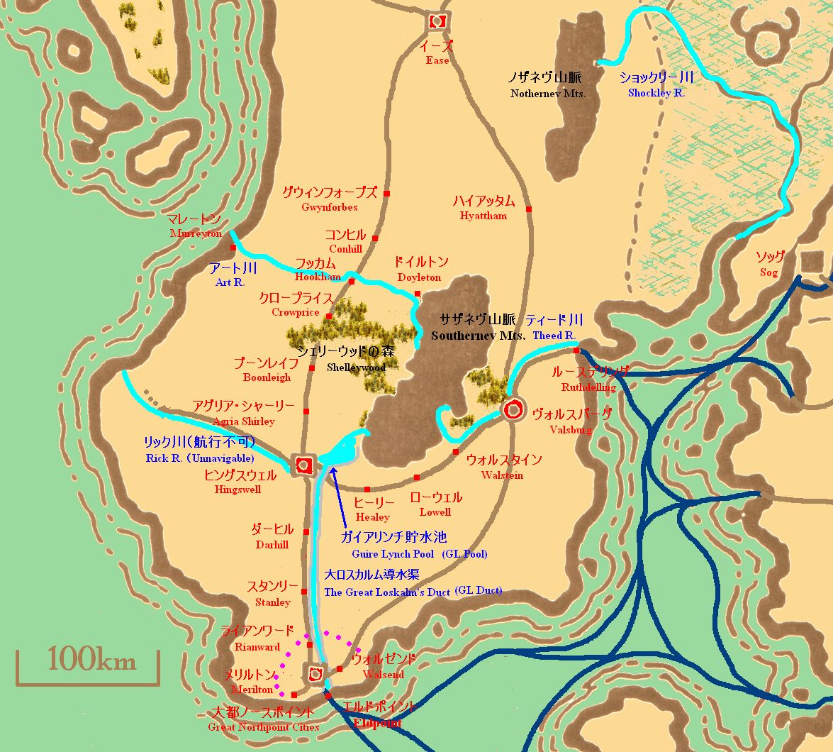
North Loskalm (234kb)
drawn by Efendi
Liber ob Sciscitatora
|
Efendi の私的な設定によるロスカルム王国北部の地図。とりあえず、当面のシナリオに使う部分しか設定してません。 This map shows North Loskalm of the version that Efendi designed. I'm sorry that I designed a part that I as a game master will use in my scenario. |